 Guyane-SIG
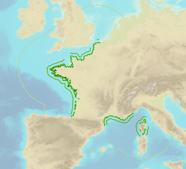
Navigation categories for professional ships
Simple
- Date (Publication)
- 2016-07-29
- Credit
- ©Shom
- maintenanceAndUpdateFrequency
- As needed
- Theme
-
- navigation category
- limit
- regulation
- product
- open data
- Use limitation
- Opendata license (version 2.0, April 2017), defined by the Etalab mission.
- Use limitation
- Data may be freely used providing that the source is mentioned.
- Use limitation
- Do not use for navigation
- Use limitation
- Opendata license (version 2.0, April 2017), defined by the Etalab mission.
- Access constraints
- Other restrictions
- Use constraints
- License
- Other constraints
- No public access restrictions
- Classification
- Unclassified
- Spatial representation type
- Vector
- Denominator
- 25000
- Metadata language
- freFrançais
- Character set
- utf8 UTF8
- Topic category
-
- Boundaries
- Oceans
- Description
- France
))
- Reference system identifier
- EPSG / WGS 84 / Pseudo-Mercator (EPSG:3857) / 7.9
- Distribution format
-
-
SHP
(
-
)
-
SHP
(
-
)
- OnLine resource
-
Shom Geoportal
(
WWW:LINK-1.0-http--link
)
Shom Geoportal
- OnLine resource
-
DAM_LIMIT_CAT_NAVIGATION_WMSR
(
OGC:WMS
)
WMS
- OnLine resource
-
DAM_LIMIT_CAT_NAVIGATION_WFS:categorie2_lines_3857
(
OGC:WFS
)
WFS Category 2
- OnLine resource
-
DAM_LIMIT_CAT_NAVIGATION_WFS:categorie3_lines_3857
(
OGC:WFS
)
WFS Category 3
- OnLine resource
-
DAM_LIMIT_CAT_NAVIGATION_WFS:categorie4_lines_3857
(
OGC:WFS
)
WFS Category 4
- OnLine resource
-
DAM_LIMIT_CAT_NAVIGATION_WFS:categorie5_lines_3857
(
OGC:WFS
)
WFS Category 5
- OnLine resource
-
CATEGORIE_NAVIGATION.7z
(
WWW:LINK-1.0-http--link
)
Download service
- Hierarchy level
- Series
- Statement
- The digitalised geographic data was produced in application of section II.14 of article 1 of decree no. 84-810 amended on 30 August 1984. Navigation categories are defined in article 110.10 of the rules appended to the order of 23 November 1987 on shipping safety.
- File identifier
- BDML_DAM_LIMITE_CAT_NAVIGATION.xml XML
- Metadata language
- Français
- Character set
- UTF8
- Hierarchy level
- Dataset
- Hierarchy level name
- Produit
- Date stamp
- 2021-10-19T17:10:15
- Metadata standard name
- ISO 19115:2003/19139
- Metadata standard version
- 1.0
Overviews
Spatial extent
Provided by
