 Guyane-SIG
France
Type of resources
Available actions
Topics
Keywords
Contact for the resource
Provided by
Years
Formats
Representation types
Update frequencies
status
Service types
Scale
Resolution
-
Collection of aerial photographs acquired by Institut Géographique National (IGN) in French Guiana. All the aerial photographs are available for free on the IGN geoportail.
-

This landscape dataset was built using Shuttle Radar Topography Mission (SRTM) data with full resolution (1 arc sec ~ 30m). This map aims at evaluating the geodiversity of natural areas. Twelve landscape types into 5 main categories have been identied with respect to Migon's typology (2006): the coastal plains landscapes (AA. AB. AC); the typical multi-convex landscapes (B. I. J); the multi-concave and joint-valley landscapes (C.D); the more or less dissected plateau (E.F.G) and the all-slopes topography (H). The map was produced at the request of the French Guianan public forest manager of the Office National des Forêts (ONF).
-

The UMR EcoFoG possesses several servers of administration or calculations. All are situated within the building INRA, office 207, of the Agronomic Campus of Kourou, French Guiana. The servers of calculations are: 1. Carapa, Tabebuia and Amandier: servers of calculation under Linux (Ubuntu), each possesses a server RStudio which allows to throw calculations under R from a Web browser (Firefox rather). 2. Wanakouali : His use is reserved for the supercomputing under Windows. His storage capacity is reduced (400 Go) but its hard drives are very fast. Installed softwares : R, Révolution R, RStudio, Tinn-R, OpenBUGS, MATLAB.
-
Subset of the image that covers the area around Saint Georges in French Guiana.
-

Subset of the image that covers the area around Saint Georges in French Guiana.
-

The image covers the site Rivière Grand Inini in the center of French Guiana.
-

Subset of the image that covers the area around Saint Georges in French Guiana.
-

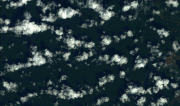
The image covers the area between Kourou and Sinnamary near the guyanese spatial center in French Guiana.
-

Subset of the image that covers the experimental site Nouragues in French Guiana.
-

The image covers the experimental station Paracou in French Guiana.