 Guyane-SIG
Imagery base maps earth cover
Type of resources
Available actions
Topics
Keywords
Contact for the resource
Provided by
Years
Formats
Representation types
Update frequencies
status
Scale
Resolution
-
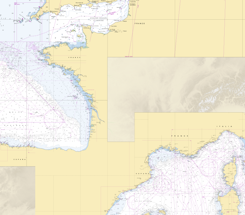
RasterMarine is a series of digital images taken from nautical charts, with no additions, legends or georeferencing information. The RasterMarine range is available at five sets of scales: - RasterMarine 20 1: 20,000 - RasterMarine 50 1: 50,000 - RasterMarine 150 1: 150,000 - RasterMarine 400 1: 400,000 - RasterMarine 1M 1: 1,000,000. Unless exceptional circumstances apply, the RasterMarine range is updated on a weekly basis and the modified grid squares are re-published, replacing the previous versions. All corrections, publications and editions with an effect on the reference nautical charts are taken into consideration. <br /> 17/04/2025 version <br />
-

The georeferenced digital image solution for the nautical chart is a digital conversion of the corresponding printed nautical chart produced by Shom or its legends, with georeferencing indications and including miscellaneous text.
-
Collection of aerial photographs acquired by Institut Géographique National (IGN) in French Guiana. All the aerial photographs are available for free on the IGN geoportail.
-

The image covers the experimental station Paracou in French Guiana.
-

Subset of the image that covers the experimental site Paracou in French Guiana.
-

Subset of the Pléiades image that covers a small area in the Northwest of Oiapoque near Saint Georges in French Guiana.
-
Subset of the image that covers the area around Saint Georges in French Guiana.
-
Subset of the Pléiades image that covers the experimental station Paracou in French Guiana.
-

The image is available for free on the USGS Glovis website.
-

The image is available for free on the USGS Glovis website.