 Guyane-SIG
5000
Type of resources
Available actions
Topics
Keywords
Contact for the resource
Provided by
Years
Formats
Representation types
Update frequencies
status
Scale
Resolution
-

The site Crique Armontabo is composed of four 3km-transects (20m wide). 5183 trees with dbh>=20cm have been recorded by Office national des forêts (ONF). Fauna inventories have been made by Office national de la chasse et de la faune sauvage (ONCFS) few days after. No under-storey plants inventory available. Soils have been described using 12 samples (1.20m depth max.). Laboratory analyses are available for one soil-profile.
-

The site Paracou is composed of two 3km-transects (20m wide). 2438 trees with dbh>=20cm have been recorded by Office national des forêts (ONF). No fauna inventories. No under-storey plants inventory. Soils have been described using 6 samples (1.20m depth max.). No laboratory analysis available for soils.
-

The site Saut Parasol is composed of four 3km-transects (20m wide). 4423 trees with dbh>=20cm have been recorded by Office national des forêts (ONF). Fauna inventories have been made by Office national de la chasse et de la faune sauvage (ONCFS) few days after. 716 under-storey plants have been recorded on 21 25m²-plots by Institut de recherche pour le développement (IRD). Soils have been described using 20 samples (1.20m depth max.). Laboratory analysis are available for one soil-profile.
-

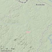
Several forest inventories in mangroves were conducted in different places and on different dates. Inventories take place at 6 main locations : Iracoubo, Sinnamary, Macouria, Cayenne, Petit Cayenne and Kaw. 1. at Iracoubo, forest inventories were carried out in 2003 and cover an area of 4800 m², 2. at Sinnamary, forest inventories were conducted in 1997, 2003 and 2004 on 9440 m², 3. at Macouria, 2824 m² were inventoried in 2006, 4. in the south-west of Cayenne, 10800 m² were inventoried in 1993, 5. at Petit-Cayenne, forest inventories were conducted in 2011 on 10000 m², 6. and in the Area of Kaw, three inventories in 2002, 2004 and 2005 cover an area of 34925 m². During the forest inventories, the collected data concern DBH, overall height or 1st branch height, the inter-trees distance in a forest plot, sometimes the surface salinity and state of the tree (living/dead).
-
This dataset summarizes the facilities that can be used within labex CEBA for the scientific work.
-

The experimental site of Guyaflux in the Paracou forest (Sinnamary, French Guiana) has been created in 2003 and is set up for at least 20 years. Guyaflux has several aims : 1. to characterise the greenhouse gases exchanges between the forest ecosystem and the atmosphere. 2. to assess the contribution of Guianese tropical humid forest ecosystem to the biospheric carbon sink. 3. to assess the impact of environmental constraints on carbon footprint. 4. to analyze the contribution of different compartments of the ecosystem (soil, subsoil, canopy) to storage and water and carbon flows. 5. to model the primary productivity of this ecosystem by linking carbon flow and tree growth. 6. to assess interactions between water cycle, carbon cycle and major soil minerals (nitrogen and phosphorus) The experimental set-up is composed of a 55m-high flux tower, which measures gases exchanges in real-time.Several data types are registrated : microclimatic data, carbon and water flows between forest ecosystem and atmosphere, CO2, CH4, H2O, water content of the soil, trees growth, evapo-transpiration from the trees...To obtain the flows of water and carbon, the turbulent correlations method is used. The project owner is Institut national de la recherche agronomique (INRA). NORELEC is the master builder of the tower. The Guyaflux project received 55% of its funding by INRA and 45% by Ministry of Research and European Union.
-
Guyadiv is a network of permanent forest plots installed in French Guiana. The site of Guyadiv in Counami is composed of 19 1200sq.m-plots. A complete inventory has been made on these plots, during 3 inventory sessions in 2000, 2001 and 2002. 1743 trees have been inventoried, with 92,2% to 100% of trees identified to species level. We only have the point coordinates and not the precise demarcation of the sample plots. In order to calculate the bounding box for these plots, we have expanded the point location 500 meters in each direction.
-

Guyadiv is a network of forest inventory plots installed in French Guiana. In Paracou experimental station 2 sets of plots pertain to the Guyadiv network Transects (> 2cm dbh) Ten 20x250m-transects have been inventoried within ten larger experimental plots. In those plots all stems > 2cm dbh have been censused (mapped and identified to species level). Plots were measured twice (once between 1994-1998, and once in 2002) 3 transects in plots subjected to treatment 1 (commercial logging only, of trees of DBH>50cm between 1986 and 1988, on average 10 stems per ha) 3 transects in plots subjected to treatment 2 (commercial logging as treatment 1 + thinning by poison-girdling of all non-commercial species of DBH≥40cm between 1986 and 1988) 3 transects in control plots (without treatments) 1 transect in plots subjected to treatment 3 (commercial logging + logging for fuelwood of all non-commercial treed of DBH between 40 and 50 cm + thinning of trees of more than 50cm DBH between 1986 and 1988) In addition 10 0.5 ha plots within the Guyaflux foot print have been set-up in which all trees > 10cm dbh have been inventoried.
-

The Paracou Research Station encompasses 5000 ha of tropical rain forest near Sinnamary, French Guiana, and is accessible by paved road. The site includes several types of forest plots, each with unique research objectives. Logging Plots: Fifteen nine-hectare plots (numberred 1 to 15) were established in 1984 to study the impact of different logging treatments on tropical tree population structure. This zone is reserved exclusively for studies investigating the impact of the different logging treatments on forest populations. Primary Forest Plot: A 25 hectare plot (no. 16) was established in 1991 for studies of undisturbed forest. Researchers whose interests are unrelated to the effects of logging treatments are encouraged to conduct their work in this plot. Clearcut Plot: a 6.25 ha plot (no. 17) was established in 1989 at a nearby reserve along the road to St. Elie to study the effects of clearcutting on tropical forest dynamics
-

The site Régina is composed of two 3km-transects (20m wide). 1958 trees with dbh>=20cm have been recorded by Office national des forêts (ONF). No fauna inventories available. 284 under-storey plants have been recorded on 14 25m²-plots by Institut de recherche pour le développement (IRD). Soils have been described using 13 samples (1.20m depth max.) and two soil pits (1.50m depth). Laboratory analyses are available for one profile and for the two soil pits